New photos have captured ‘fascinating’ scenes of Mars’ North Pole, where vast sand dunes and icy cliffs cover the surface.
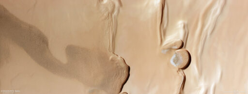
Mars’ North Pole, Planum Boreum, is covered in layers of fine dust and water ice, the European Space Agency (ESA) has found in striking new images. These layers stack several kilometers thick and stretch out 1000km (the width of France).
The ESA say the wrinkling in the image shows layers of material are starting to build up, made up of a mix of dust, water ice and frost, which has settled on the Red Planet over time. Each layer can hold vital information about the Martian planet’s history, describing the past climate and what has changed over the past few million years.
In the winter, Mars’ layers are topped by a thin cap of dry ice (carbon dioxide ice) which sits a couple of meters thick. But it disappears each summer.
READ NEXT: iPhone users can now see the monster black hole in the Milky Way with just an app
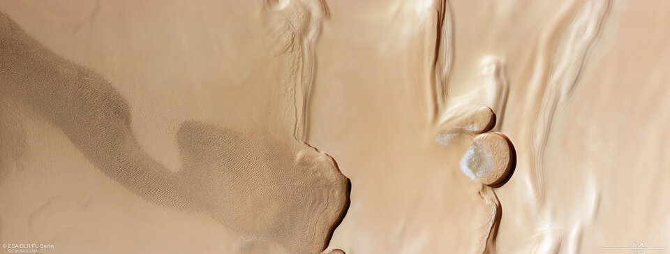
The Mars Express High Resolution Stereo Camera (HRSC), captured the new images, where you can see two steep banks travel down the middle of the photo. The ESA explains they mark the boundary between the layers and the vast, sweeping dune fields.
In other pictures, there are stark differences between smooth ripped sand dunes and wrinkled areas, with scientists believing the smooth areas are young, being rejuvenating every year. The surface lacks signs of erosion and the aftermath of collisions from space – incoming rocks and space debris.
The lines in between the two areas sit semicircular cliffs, with the biggest being 20km wide, and within the curves, frost-covered sand dunes reside. The steep, icy walls reach up to 1 km high.
READ NEXT: Sun erupts most powerful solar flare in 7 years as experts issue warning over GPS and satellites
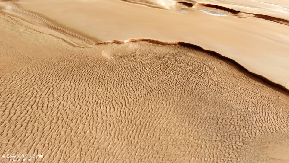
Found at a polar trough, they create a spiral-like pattern of the polar plateau.
The HRSC has been orbiting the Red Rock since 2003, mapping minerals, capturing images of Mars’ surface, probing beneath the crust, identifying the composition and circulation of the atmosphere and exploring the environment.
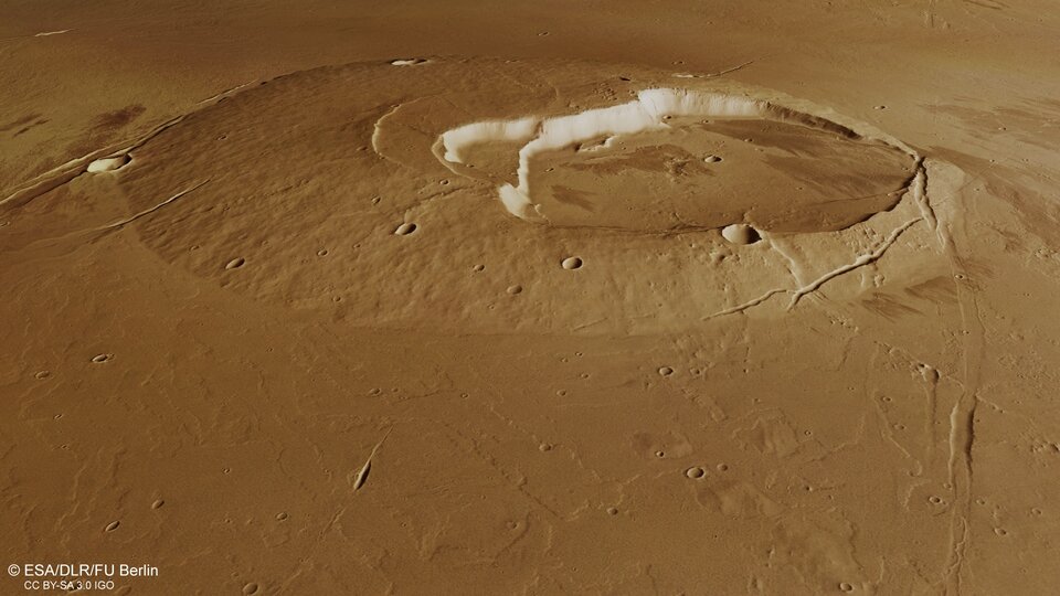
It’s found sinkholes on the flanks of colossal volcanoes, wind-sculpted ridges, impact craters, river channels and ancient lava pools.
The HRSC was developed and is operated by the German Aerospace Center.
An example of one of the lava pools below.
READ NEXT: Giant cavity left behind after one of most powerful eruptions ever from black hole
